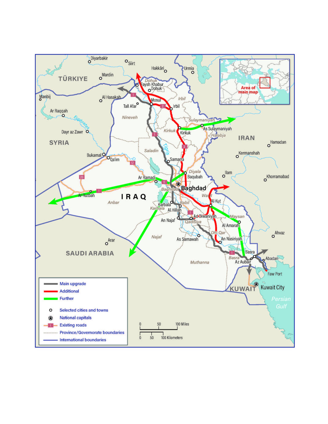
The Ministry of Transport moved forward with a major milestone by delivering land maps to local governments. These maps will help launch the Development Road across several southern provinces.
The ministry announced that its technical teams provided both paper and electronic cadastral maps. These maps were handed to the administrations in Dhi Qar, Muthanna, Diwaniyah, and Basra. Officials noted that these deliveries aim to speed up preparations for the major transportation corridor.
Each map clearly shows the central route of the project. It also includes coordinates, plot numbers, and district divisions. These details will support the upcoming land acquisition efforts. The documents give local authorities everything needed to begin land surveys.
The Director General of Railways personally gave the maps to Dhi Qar’s acting governor. Another team from the ministry traveled to the other provinces to complete the handovers. Each local government received both physical and digital copies of the maps.
To launch the Development Road, local committees will begin surveying and acquiring land. Each governor will lead their province’s committee. These teams will include members from key government institutions. Their job is to identify affected areas and secure the land legally.
The cadastral maps make the process more efficient. They help avoid delays and support fast implementation. With clear boundaries and data, committees can take immediate action. This marks an important step toward turning plans into progress.
The ministry’s approach shows strong coordination and planning. It reflects the government’s focus on major infrastructure projects. These efforts are designed to improve transportation, connect regions, and boost the economy.
This move sends a message of readiness. Iraq stands prepared to launch the Development Road and unlock new opportunities. With the groundwork laid, further steps will follow quickly to bring the project to life.

